Italia e Estero

Google Maps rinomina in Usa Golfo del Messico in Golfo d'America
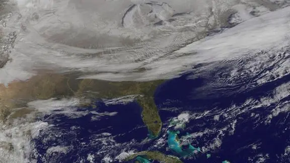
epa04550976 A handout photo provided 08 January 2015 by the National Aeronautics and Space Administration (NASA), NOAA's GOES-East satellite providing a look at the frigid eastern two-thirds of the U.S. on 07 January 2015, that shows a blanket of northern snow, lake-effect snow from the Great Lakes and clouds behind the Arctic cold front. A visible picture captured at 11 a.m. EST showed the effects of the latest Arctic outbreak. The cold front that brought the Arctic air moved as far south as Florida, and stretched back over the Gulf of Mexico and just west of Texas. The image shows clouds behind the frontal boundary stretching from the Carolinas west over the Heartland. Farther north, a wide band of fallen snow covers the ground from New England west to Montana, with rivers appearing like veins. The GOES-East satellite image also shows wind-whipped lake-effect snows off the Great Lakes, blowing to the southeast. Meanwhile, Florida, the nation's warm spot appeared almost cloud-free. EPA/NASA / NOAA GOES Project / HANDOUT HANDOUT EDITORIAL USE ONLY
AA

ROMA, 28 GEN - Google Maps rinominerà il Golfo del Messico in Golfo d'America negli Stati Uniti, in linea con l'ordine esecutivo del presidente americano Donald Trump. Nel resto del mondo saranno invece utilizzati entrambi i nomi. Lo riporta il Guardian sottolineando che il nome resterà Golfo del Messico in Messico. Anche la cima dell'Alaska, Denali, la montagna più alta del Nord America, verrà modificata in Monte McKinley negli Stati Uniti, in linea con le disposizioni del presidente Usa. "Abbiamo una prassi consolidata di applicare i cambiamenti di nome quando sono stati aggiornati dal governo ufficiale", ha affermato Google in un post su X. "Quando i nomi ufficiali variano tra i Paesi, gli utenti di Maps vedono il loro nome locale ufficiale. Tutti nel resto del mondo vedono entrambi i nomi. Ciò vale anche qui", ha precisato Google Maps.

Riproduzione riservata © Giornale di Brescia

Condividi l'articolo

Iscriviti al canale WhatsApp del GdB e resta aggiornato

Argomenti